Boring Art, Boring Life: Mt Arrowsmith -- The First Hike of 2015
Mt Arrowsmith -- The First Hike of 2015
Arrowsmith is, arguably, the most hiked mountain on Vancouver Island. I'm sure there are other hills that are more commonly hiked, Mt. Bension, Mt. Finlayson and even Mt. Tzouhalem come to mind. However, they are each below 1000 m. Arrowsmith, at 1819 m (5967 ft), is just short of the magic 6k figure that would put it on the illustrious list of 6000 footers on Vancouver Island. Regardless, I consider Mt. Arrowsmith a great day hike. It offers multiple routes for those that are interested in varying degrees of challenge.
 |
| Chute leading toward the summit |
Total Distance: 7 km
Starting Elevation: 745 m
Maximum Elevation: 1819 m
Total Elevation Gain: 1100 m
Time: 6.5 hours
January 3rd, I joined the Island Mountain Ramblers, on the first hike of the year! In total 13 hikers, gathered to make the winter ascent of the commonly hiked Judges Route. Trail Peak has a good description of the route and detailed information about the hike.
We met at Chapters in north Nanaimo, after fueling up with coffee and formal introductions of several guest hikers, we were on the road shortly after 6:30. I was a little concerned about our ability to reach the trailhead. Island Timberland's indicates that there is active logging in the immediate area. They are allowing weekend access to the area but I was unsure what we would find. My fear was a completely denuded post-apocalyptic mountainlscape. My fears were not entirely true. The only significant difference I noted was a red gate marked 270. I'm not sure when it was added, though I don't remember seeing it before. We parked, assessed the overcast weather and looked longingly toward the summit, enshrouded in cloud. We were dressed and heading up the old logging spur around 8 am.
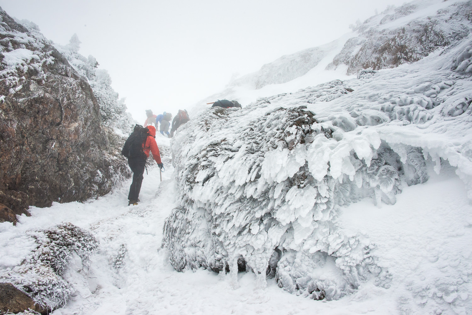
 |
| 1320 m, the snow finally accumulates on the ground |
Even before we reached the start of the flagged route leading to the summit, we crossed our first patch of snow; around 800 metres. The hiking was slower than normal, in part due to the number of hikers but mainly due to the condition of the ground. The cold air temperature created a frozen trail, though there was little build up of snow. After a hour and half of hiking we made it to about 1250 meters where most of the hikers put on their crampons and pulled out their mountaineering axes. Around 1320 metres, the dry crunchy snow started to gain enough depth to start kicking steps.
We easily followed a booted path up the side of the mountain and ultimately to summit. As we hiked up the final gully wind began to pick up. Each of us donned hats and windproof gear and continued to the summit.
 |
| David & Christ plowing forward |
We reached the summit at 11:30. the wind was blowing strong, probably around 20 knots. Ice fingers were building on the phallic-repeater cones, on the summit. Further, frost crystals were forming on the our clothing, hats, and even some eyebrows! We only dallied long enough to sign the register and pose for a few photographs. We beat a hasty retreat to a lower elevation, out of the wind to enjoy some lunch.
 |
| John's icy stare freezes me in |
The hike down the mountain was quick and without event. of note, I removed my crampons too early and the frozen trail proved to not be my friend. We arrived back at the car around 2:30pm, safe and sound. We loaded into our car and head home.
View the full album of 30 photographs...
Labels: Island Mountain Ramblers, mountain, mountaineering, Mt Arrowsmith, Trip Report, Vancouver Island


