Boring Art, Boring Life: Mount Phillips via Arnica Lake
Mount Phillips via Arnica Lake
I'm using Island Alpine as a benchmark of mountaineering achievement, a checklist of mountains to summit. It mostly leads me to exciting adventures which I approach with anticipation, but every so often I find a hike where my expectations are low. Setting out to hike Mount Phillips in Strathcona Park is an example. In August 2013, I hiked the lengthy Phillips Ridge to the peak of Vancouver Island, The Golden Hinde. I assumed I would be hiking a well-booted trail through open terrain to a summit that many people regularly visit. The day would blow my expectations out to the water.
Total Distance: 29 km
Starting Elevation: 350 m
Maximum Elevation: 1722 m
Elevation Gain: 1900 m
Total Time: 9.5 hours
Our new hiking tradition seems to be setting out well before dawn. On Sunday, October 18th, we set out from Phil's house at 5:30 am, and arrived at the trailhead near the Nystar Mine not too long after sunrise. On the drive in we were mired in dense fog, but temperatures were warm, around 12 degrees, even before dawn. We were in for a cracker of a day!
We started our hike at 8:30 and hit the Arnica Lake Trail (350m) in the blue cast of early morning light. I'll admit a certain disdain for this trail. It was built for a different era, developed by Don Apps as a trail for accessing Phillips Ridge and the Golden Hinde. Although today the fastest recorded trip is under 17 hours to complete the 63-kilometre round trip, in those days, trips were much longer due to route-finding and heaving mountaineering packs that could weigh between 75 and 100 pounds. The trail was designed with a grueling number of switchbacks as it leads to the lower portion of the ridge and Arnica Lake around 1200 metres elevation. As the bird flies, the distance is only about 2 km from the car, but with all the switchbacks the distance would make up half of the day’s total horizontal distance traveled: 7 km from the car to the lake (14km return).
 |
| out of the trees on approach to Arnica Lake |
Regardless of the distance to the lake, it's an easy walk through mature forest and past some large trees as you hike back and forth, back and forth, back and forth, etc. The trip might be enjoyable if not for the constant drone of the operating mine in the distance that persists well up to 1000 metres. I'll be using this trail again this summer, as Kim and I plan to bring our son on his first alpine camping trip to Arnica Lake.
 |
| View of Phillips Ridge over Arnica Lake |
The sun greeted us as we walked out of the forest, and blue graced the sky as we reached the lake's edge. We followed a sign and the booted route toward Phillips Ridge Junction, but this was a mistake. We moved quickly, and before we realized it, we were getting far off route from our destination of Mount Phillips. Rather than backtracking to the lake, we cut through the landscape; definitely not a mistake!
 |
| Sun through the trees |
Understand when I use the word ‘route’, I mean the way we traveled. There are only the roughest remnants of an established route, and more likely we probably walked along game trails. We picked our way over rolling hills and through light bush, around small lakes and through open meadows. Honestly, we may be the first folks to walk the area, or at least the first in really long time. We aimed for the far edge of the ridge (the west face). Once on it, we had a better view of our route ahead. It gains and loses elevation as it swings around a deep valley, traveling southwest and wrapping around to the north.
From the west side of the ridge, we picked up a very patchy established route; definitely not something that we could follow, but we touched it again and again as we wound our way over the bumps to the summit. We stayed low over the high bumps to avoid elevation gain, but always aimed to stay central on the ridge. Particularly of note, there is a narrow edge to the ridge, immediately after the largest bump around 49.602728, -125.584066.
 |
| cresting a high point we view the ridge beyond |
 |
| from the narrow saddle we view the valley |
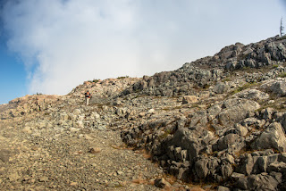
 |
| Phil, wending his way through the alpine to a high bump en route to Mount Phillips |
As we approached the final 750 metres of horizontal distance to the summit, we stayed on the hikers’ right and found a nice grass gulley, which follows a slope up to the high alpine choss. We continued on the choss, staying low and to the left of the main ridge. As we trekked, the route wrapped around the east side of the broad summit and we achieved quick easy access to the high point.
 |
| the gully leading to the choss, before the summit |
The view was spectacular! We could see in all directions: Golden Hinde, Marble Peak, Buttle Lake, and much of Phillips Ridge. The cairn is small and held an even smaller register, a black PVC pipe placed in July 1986 by the Island Mountain Ramblers and the CDMC. The contents were dry, but the pipe was stuffed with small pieces of paper so we only added our names.
 |
| CDMC & IMR register, full! |
We ate lunch, then left for home around 2:00 pm. On the return, we followed our own route to the bump at the head of the valley. From here, we picked a heading that would take us back to Arnica Lake. This route brought us through terrain with beauty that matched anything I've seen in Strathcona Park; in particular, the large meadow is stunning. We eventually spotted a cairn, then started following a string of cairns and flags down through the forest and rocky steppes to intersect the well-booted route we used in the morning, again passing Arnica Lake.
 |
A view from Mount Phillips,
Buttle Lake |
 |
| Phil Mounting Mount Phillips |
We were happy to see the lake; time was ticking along and it was 4:30pm as we took our first steps on the long trail down to the car. Phil was quicker than me as we hiked, and he beat me to the car by at least ten minutes. I had a cramp in my shin, likely caused by an overworked foot muscle. However, even I made it back to the car before 6:00 and before dark fell.
 |
| looking back from the trail, into the woods you go |
As a final note, if you do consider visiting Mount Phillips, consider using our return route. It will save you at least an hour of hiking, and a few hundred metres of elevation gain. Shortly after Arnica Lake, step into the trees and find the lightly-flagged route up the ridge line to the open meadow. Strong route-finding skills and a map or GPS are mandatory. Doing so will save time, but you will miss some truly spectacular meadows and rarely-visited sections of the plateau.
View the album of 28 photographs...
Labels: Hiking, Island Mountain Ramblers, Mount Phillips, mountaineering, Phillips Ridge, Strathcona Park, Trip Report


