Boring Art, Boring Life: Family Day weekend adventure to Stowe Peak.
Family Day weekend adventure to Stowe Peak.
Is there a difference between hiking and camping for three days, versus doing three hikes in three days? It sure feels like there is.
For Family Day weekend 2016, I ventured out on three day-trips, each with a different group of friends. The first trip was a beginner/family snowshoe around Lake Helen Mackenzie; the second, an intermediate snowshoe to the summit of Mount Allan Brooks. The final trip, and the topic of this post, was a more serious hike ascending majestic Stowe Peak.
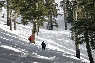 |
| A group of two men descending from the Stowe-H'kusam Col |
Stowe Peak is located in the Prince of Wales Range, which lies between Campbell River and Sayward. Geographically, this range is unique as compared to the south island. The mountains erupt on the edge of the Johnstone Strait, in some cases towering right out of the sea, and quickly rise to elevations greater than 1500 metres.
Total Distance: 17.5 km
Starting Elevation: 41 m
Maximum Elevation: 1607 m
Elevation Gain: 1789 m
Total Time: 9 hours 35 minute
H'kusam Mountain is the most well-known feature in the range, and it lends its name to the annual Kusam Klimb, which crosses the col between H'kusam and Stowe Peak. Stowe Peak is north along the ridge of peaks, located between Springer Peak and H'kusam Mountain. If you look on a map, however, you won't find the mountain marked – “Stowe Peak” is not an official name. Instead, you will find an unmarked feature, over 1500 metres tall. In calling it Stowe Peak, I'm using the moniker assigned by Phillip Stone, and it's his route description that we used to access the peak.
The quickest way to access this peak is from the Stowe Creek Trailhead, but it requires a vehicle with 4-low and high clearance to reach. Lacking this, we used the longer and more grueling approach via Bill's Trail. Bill's Trail offered us a number of advantages: no off-road driving, a place to camp at the trailhead the night before, and a more interesting challenge.
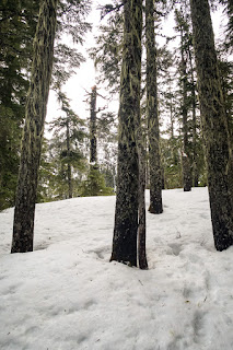 |
| the booted path through easy to navigate forest |
On February 7th, Phil and I participated in the Island Mountain Ramblers trip to Mount Allan Brooks, an intermediate snowshoe trek. Instead of returning to Nanaimo that evening, we camped in the lot at the head of Bill's Trail. We arrived in the dark, expecting to find ourselves alone, but discovered an RV parked for the night, with lights on and nobody home. We set up our tents, prepped some equipment for the morning, and spent some time practicing knots with a length of shoestring.
Our sleep was interrupted by the sound of inebriated people carrying bags of booze back to the RV. This poor sleep made waking before first light even more difficult. I prepped my coffee in the vestibule of my tent, snug in the comfort of my sleeping bag. I enjoyed the moment, using it as motivation for the day.
We broke camp and packed; our car was loaded and backpacks on before 7:30 am. Approaching the trailhead, we noticed two young men walking the same way. We greeted each other, but they were obviously intent on their goal, because they didn't spend more than two minutes chatting before scooting up the trail ahead of us.
This was our second time using Bill's Trail for an approach route to a mountain. Not long ago, we hiked Springer Peak with another friend. At that time, the ground was frozen, and each step was potentially treacherous. Today, the weather was warmer and the trail was typical loose dirt, offering good traction. We were not as fast as we could have been, as I was winded from the two prior days of adventure. Regardless, we made good time at our slow and steady pace.
Snow made its first appearance around 650 metres, with blobs of rained-out snow on the side of the trail. The snow became deeper as we climbed, and by 750 metres we were following deeper and deeper footsteps left by the guys in front. Our strategy was to let the younger men head on past us (as though we could stop them!) and do more of the work breaking the trail. Eventually, the snow became too deep to walk in; at one point, we were walking in steps 30 centimetres below the level of the snow. Progress was slow, but we were reluctant to put snowshoes on before mounting up and over Keta View Rock, the first obstacle worth noting on the trail. Following in others’ footsteps is much faster than breaking trail, and inevitably we caught up to the men in front of us, who were putting on their snowshoes. Phil and I decided we would do the same. We chatted briefly as we ascended - they recognized us from photographs on the blog. It's a bit surreal to be recognized!
 |
| looking back from the top of Keta View Rock |
Within a few minutes of putting on our snowshoes, we were at Keta View Rack (1220m). In the summer, it's a 5-10 metre step onto a slab of rock above - little more than an inconvenience, likely not even a scramble. The snow, however, creates a different situation: a steep snow slope that hindered our progress. The concern is the potential for falling; closer to the top of the step you make a left turn, and a fall here could be fatal. There is very little runout to allow time to self-arrest, and a fall in the wrong direction may shoot you off the bluff. We carefully cut a path diagonally up the short steep slope using our mountaineering axes for self-belay (probably more for mental easement than actual function).
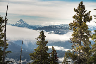 |
| rewarding views of Victoria Peak and more |
Once on top, we walked to one of the Kusam Klimb aide stations, the last one on this side of the range. This small covered area serves as an aide station for the annual race, and is also a fantastic viewpoint for the valley below! After catching our breath and taking some photos, Phil and I carried on, leaving the other group behind. We had our GPS track from Springer running, but even in the snow the route is easy to follow as there are frequent ribbons in the trees.
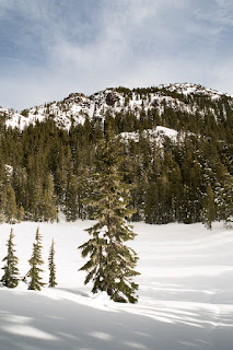 |
| at the bottom of the circ at the frozen lake, Stowe in the background |
We continued on our way. At some point, I lost track of the summer route: I followed the GPS track too carefully, and climbed to a higher elevation closer to Springer - not where we wanted to go. However, I wasn't worried. We contoured along the slope between the trees, moving toward a section of the summer route on the same elevation. We regained the summer route at the shoulder (~1450m) where the route drops off into a deep bowl, near the lake (1400m). Getting off-route and climbing higher didn't cause us to lose or gain any unnecessary elevation. There was no disadvantage in the snow, but I'm not sure the track would be suitable in the summer. It would be best to follow the regular summer route, which we did on the way back to the car.
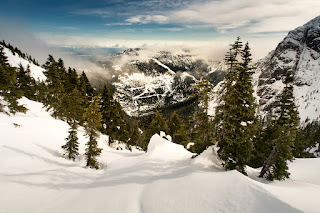
We stood at the drop-off around 11:45am. From this point we were walking in the sun - the weatherman got the forecast right for once! We had excellent views of the circ below us, the valley beyond to the south, and the col between Stowe and H'kusam to the east: our next goal. We paused to examine the summit in the distance, looking for the best route. It looked spectacular. The slope to the frozen lake is steep and wanders through the trees. I resisted the urge to take a direct route through the trees to the bottom. We zigzagged back and forth, descending generally southeast, plotting a good set of switchback that we would use on our way back home.
 |
| from the Stowe-H'kusam col looking north to the hidden Stowe Peak summit |
 |
| from the Stowe-H'kusam Col looking northeast |
I was conscious of the time. Though the GPS told me the goal was near, perspective in the mountains distorts my perception of distance, and the uncertain conditions on the snowy slope leading to the col made us hurry. At the base leading to the col, I was delighted to see that the route to the top was much easier than it looked from afar. It was not a challenge, other than the endurance needed to pack the snow down as we made our way up. We were at the top of the col (1470m) by 12:30 pm. Coming over the rim, we caught the first glimpse of Johnstone Strait.
 |
| H'kusam Mountain north aspect, the standard route visible |
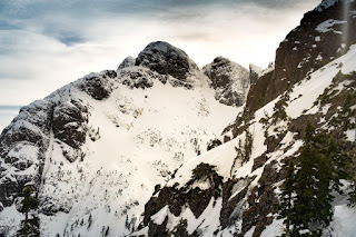
From the col, we couldn't see the best approach to the summit, but we had a general idea from our earlier observation. There was a good deal of snow built up, though there were numerous areas where rock emerged through the snow. We walked along the ridge and followed an obvious path to the right of a large rock outcropping. The route progressed up and over a series of bumps. Within a few minutes, we could see the summit high above us. We decided to take a direct route to the summit. Midway up the steep slope, I paused in exhaustion. I evaluated the snow, trying to decide if I should take my snowshoes off to kick step my way up the slope. Phil, ever confident on his snowshoes, paused not. He passed me on the slope and powered toward the summit. In the end, I kept my snowshoes on. Aided by my mountaineering axe, I worked my way up the last 100 metres to the summit.
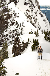 |
| looking south, Phil coming up behind me |
Phil reached the narrow summit first (1607m), around 1:00 pm. Even at a distance, I could hear his exclamation about the view. In short order I too reached the summit. Holy Hannah! The pinnacle is not even big enough for two people to stand together. As I reached the edge of the prominence, I caught a clear view of what lay beyond. The east face of Stowe drops off in an extremely steep 300 metre drop to a valley far below. We could see the knife-edge of a ridge opposing Stowe, and beyond that... magic! The entire Johnstone Strait stretched out 180 degrees north and south, with a series of islands dotting the strait and a clear view of the peaks on the mainland, including Mount Waddington! Unfortunately, I didn't get a great shot of it.
 |
| Victoria Peak visible beyond the H'kusam Ridge |
While we were taking our shots on the summit, the other two guys caught up to us. We shared a lower section of the summit for a time as each of us took our turn posing for summit pictures. Despite the sunny day, once we were on the open summit the strong breeze forced me to put on gloves and an extra layer. We took off our snowshoes and put on our crampons before plunge stepping down the steep slope. Phil took the chance to glissade, but I am always keen to develop my confidence walking on steep snow. The snow had variable depth and condition, so it was a good chance to practice walking down the slope.
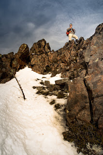 |
| Phil reached the summit first, victory! |
 |
| Phil's summit shot |
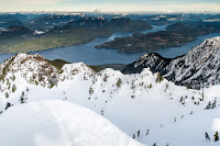  |
| Johnstone Strait beyond the Prince of Wales |
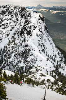
Once off the ridge and back at the lake, we put our snowshoes back on and finally stopped to eat lunch. As we looked up at the peak we just came from, we could just make out our tracks through the snow. Quite the sight!
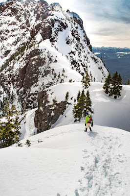 |
| descending from Stowe Peak, you can follow the tracks down to the col |
As we made our way up from the lake, I was extremely happy we had taken the extra time on the way down to create a switch-backed route. It may have cost extra time on the way down, but it saved a lot of energy and time on the way back up! Reaching the last piece of up we would do for the day, we paused to look out west from the viewpoint. The line of mountains to the west was just as fantastic as the ones to the east. The east aspect of Victoria Peak has never looked so fine!
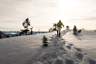 |
| taking in a final view |
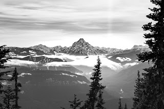 |
| Victoria Peak |
The descent to the car was uneventful. We followed the summer route back to Keta View Rock and kept our snowshoes on as long as we could. Once we were back on the bare trail, we allowed gravity to move us along as we hoofed it back to the car. We were back at 5:00pm, with just a little bit of light left; we had planned our time well. I hope the other two made it off the trail as easily as we did.
Sitting here writing my third report for Family Day weekend, I would answer my own question: Is there something different about hiking and camping for three days, versus doing three hikes in three days? Yes, I think there is, both mentally, and physically. When starting a hike fresh, one tends to push a little harder. Being that I hiked each day with a different group of people, I think those groups tended to push a little quicker. I made the most of Family Day weekend 2016. I would love to hear about your adventures - link them in the comments.
Labels: Island Mountain Ramblers, mountaineering, Prince of Wales Range, Snowshoeing, Stowe Peak


